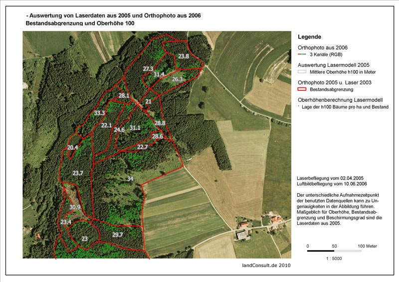
In this M.Sc thesis, a set of multi-seasonal satellite imagery from RapidEye will be applied to develop algorithms and improve the existing ones in tree species mapping across a portion of mixed forest stands in northern Black Forests in the state of Baden-Württemberg in Germany. The focus of the research will be on small private forest patches, for which conducting regular forest inventories has always been a major challenge. For most private forests (i.e. more than 30% of the forest area in Baden-Württemberg) there is a shortage of accurate and up-to-date forest inventory data.
To this aim, a set of multi seasonal RapidEye satellite imagery with a spatial resolution of about 5m are obtained from the Black Bridge company. The data cover 4 seasonally different times of the year, including March 2014, May 2013, July 2014, September 2013, and October 2012. Based on the fact that the tree species show phonological (and in turn spectral) differences during the year, these comprehensive dataset will be used here to map different tree species and other important forest characteristics, such as needle fall, storm effects or effects caused by bark beetles.
Both the results of the single tree-based aerial photo interpretation as well as those from a small area in which all pine trees have been mapped will be used as reference data. In addition, validation data can also be achieved from a number of aerial photo-interpreted stands dominated by Scots pine. The data for the neighboring public forests can also be accessed via the local forest enterprises.
The work will be carried out in close cooperation between University of Würzburg and the LandConsult company (Dr Markus Weidenbach). A Visit to the study area in the northern Black Forest is supported by the LandConsult company.
Moreover, Dr. Piotr Tompalski from the University of British Columbia (Canada) will give advices as an external supervisor.
For questions on this topic, please contact Dr. Hooman Latifi at the Dept. of remote sensing of the University of Würzburg (hooman.latifi@uni-wuerzburg.de). A more comprehensive description of this topic can be found at following address:


