

The Department of Remote Sensing at the University of Wuerzburg, Germany, seeks to appoint a PhD student with strong interest or background knowledge of remote sensing, spatial modelling and biodiversity. The context for this position is the on going modification and variation of our environment and its impact on animal movement.
We are seeking a person capable of developing spatially explicit models to predict the effects of environmental variation and urban growth on animal movement patterns in Central Europe. Significant data for calibration will be available. The successful candidate will conduct her/his PhD in the project “Opt4Environment” funded by the Federal Ministry for Economic Affairs and Energy (BMWi).
#### application closed ####
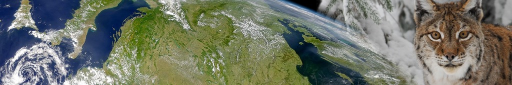
You will analyse environmental variables based or related to latest animal tracking and remote sensing tech-nology (Sentinel, TerraSAR-X, Tandem-X, Movebank.org data) that allow a better understanding of the interac-tion of vegetated and urbanized areas to assess the effects of both on animal movement patterns at appropri-ate scales. This will be coupled with ecological knowledge on impacts of vegetation variation and urban areas. Recent and current environmental impacts on movement, and new understandings of environmental dynamics with respect to animals, will inform your models. Vegetation and urban mapping within Central Europe is currently available at different scales but is increasing quickly in spatial and temporal resolution owing to new remote-sensing techniques. As data accuracy improves we will incorporate the best available information allowing us to continually improve the understanding of species-environment interaction model accuracy.
To be successful in this position you will have:
• a MSc in a relevant field (geography, biology, global change ecology, remote sensing)
• ability and interest to undertake independent research
• a strong interest and preferably also background in remote sensing, GIS or spatial modelling with re-cent experience in analysis and interpretation of complex data sets at a range of spatial scales
• demonstrated communication skills
• good skills or interest to learn the programming language R
• high interest to publish and present the outcome of this study
• high interest in interdisciplinary work
The successful candidate will receive a PhD position for 36 months (TV-L E13/2, 50% of a PostDoc salary). Please submit your application (in English) containing – as one document – a letter of interest, CV and names and contact information of two academic references by e-mail before December 15th 2014 – APPLICATION CLOSED
Contact:
This position will be embedded in an interdisciplinary collaboration with the German Aerospace Center and the Max-Planck-Institute in Radolfzell. Regular travels to these collaborating institutes are scheduled.
- Dr. Martin Wegmann, University of Würzburg
- Dr. Thomas Esch, DLR
- Dr. Kamran Safi, MPI
Further information:
The University of Wuerzburg is an equal opportunity employer that tries to increase the number of women in research and teaching. Applicants with disabilities but otherwise equal qualifications will be preferred.


