new publication: r.pi a GRASS package for semi-automatic spatial pattern analysis

new publication: r.pi a GRASS package for semi-automatic spatial pattern analysis

June 22, 2017

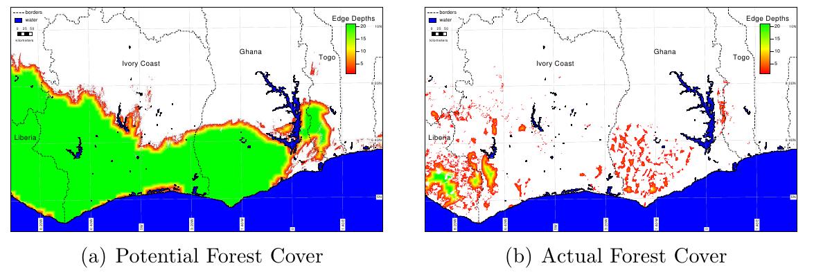
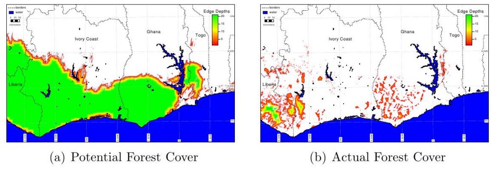
Our MEE paper on the r.pi GRASS package is now available online: “r.pi: a GRASS GIS package for semi-automatic spatial pattern analysis of remotely sensed land cover data”. This package allows a wide range of spatial pattern analysis from individual based dispersal models to graph theory or omni-directional connectivity metrics. It is part of the GRASS software and all outputs are provided in spatial formats and can be used for further processing in any spatial software such as GRASS, QGIS or R.

The full publication can be accessed here:

Wegmann, M., Leutner, B. F., Metz, M., Neteler, M., Dech, S. and Rocchini, D. (), r.pi: a GRASS GIS package for semi-automatic spatial pattern analysis of remotely sensed land cover data. Methods Ecol Evol.


you may also like:

Spring Vibes on Our Lunch Break

Spring Vibes on Our Lunch Break

With the first warm days of spring finally arriving, a small fraction of our team already took full advantage of the sunshine during lunch break—gathering outside to soak up the mild weather and enjoy a few well-earned moments of relaxation. Some of us have just...

New publication on the evolution of newly born volcanic islands

New publication on the evolution of newly born volcanic islands

New publication on the evolution of newly born volcanic islands Researchers from the Earth Observation Center (EOC) of the German Aerospace Center (DLR) in Oberpfaffenhofen, the Italian National Research Council (CNR), the Politecnico di Milano, the Space Technologies...

Terrabyte Workshop at EORC

Terrabyte Workshop at EORC

Tag: Meeting, Workshop Terrabyte Workshop at EORC This week, a two-day terrabyte workshop took place at EORC (Earth Observation Research Cluster), hold by staff members of DLR ( Dr. Jonas Eberle, Julian Zeidler, Peter Zellner). Thanks to many hours of presentations...

Advancing Paleontology Research with Multi-Sensor UAS Data

Advancing Paleontology Research with Multi-Sensor UAS Data

We are excited to share the progress of our recent collaboration with Prof. Martin Sander, focusing on the use of multi-sensor UAS data for paleontology research. This partnership aims to explore innovative approaches to mapping and analyzing fossil sites with high...

EO4CAM at the 7th Climate Conference in Veitshöchheim

EO4CAM at the 7th Climate Conference in Veitshöchheim

We are happy to share that two of our Earth Observation Research Cluster (EORC) colleagues, John Friesen and Sarah Schönbrodt-Stitt, were invited to present at the 7th Climate Conference on April 2nd in Veitshöchheim. This event, organized by the Energieagentur...