In a newly-published paper featuring Steven Hill and Hooman Latifi from Dept. of Remote Sensing, very high resolution remote sensing (laser scanner data and aerial orthophotos) were used in a full remote sensing-based framework to study post-disturbance tree and stand development, particularly in its early seral stages.
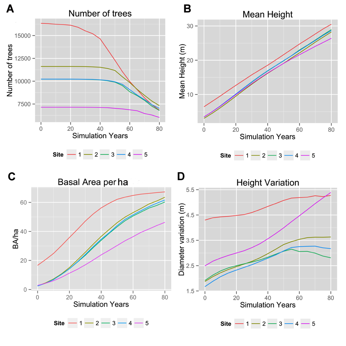
Future stand development on test sites 1–5 simulated for a period of 80 years. A) Number of trees (N) per test site. B) Basal area (BA) of trees per hectare. C) Mean tree height (MH). D) Tree height variation (MAD = mean absolute deviation).
The first step involved extraction of single trees and their allometric attributes form LiDAR-based canopy height models, after which the extracted tree locations were additionally validated by a sample based scheme implemented on aerial photos. The single tree based forest growth simulator SILVA ver. 2.2 was then used to simulate the stand development during a 80 year simulation period. In addition, landscape and spatial point pattern metrics were calculated to assess the structural heterogeneity. The results approve that natural regeneration of post disturbed forest stands reveal structural heterogeneity even at the early-seral stages. Furthermore, the study showed that the structural heterogeneity might already be determined in the early successional stages. following the bark beetle disturbances. This study open up interesting horizons in how remote sensing data and methods can be combined with spatial statistics to investigate early-phase forest dynamics in natural stands.
Further information on the published material can be found here.
Bibliography:
Hill, S., Latifi, H., Heurich, M., Müller, J. 2017. Individual-tree- and stand-based development following natural disturbance in a heterogeneously structured forest: a LiDAR-based approach. Ecological Informatics 38, 12-25. DOI: dx.doi.org/10.1016/j.ecoinf.2016.12.004