New publication: Influential factors on the quality of LiDAR-based Digital Terrain Models across temperate forest sites

New publication: Influential factors on the quality of LiDAR-based Digital Terrain Models across temperate forest sites

September 12, 2017

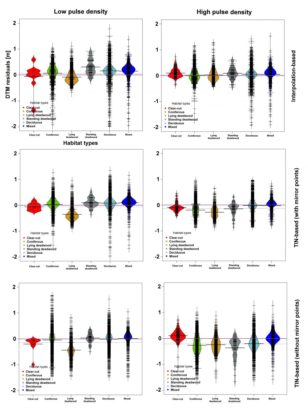
A recently published paper featuring Hooman Latifi from Dept. of Remote Sensing presents a method comparison combined with a statistical analysis on the Impact of terrain topograpghy and habitat types on LiDAR-derived Digital Terrain Models in temperate Forest sites. The study addresses essential questions raised by how data and site-driven factors such as spatial resolution, topography  and variation in forest habitat types  might affect the DTM accuracy. These factors can also play a more pronounced role added by processing steps like ground filtering and interpolation of ground points.
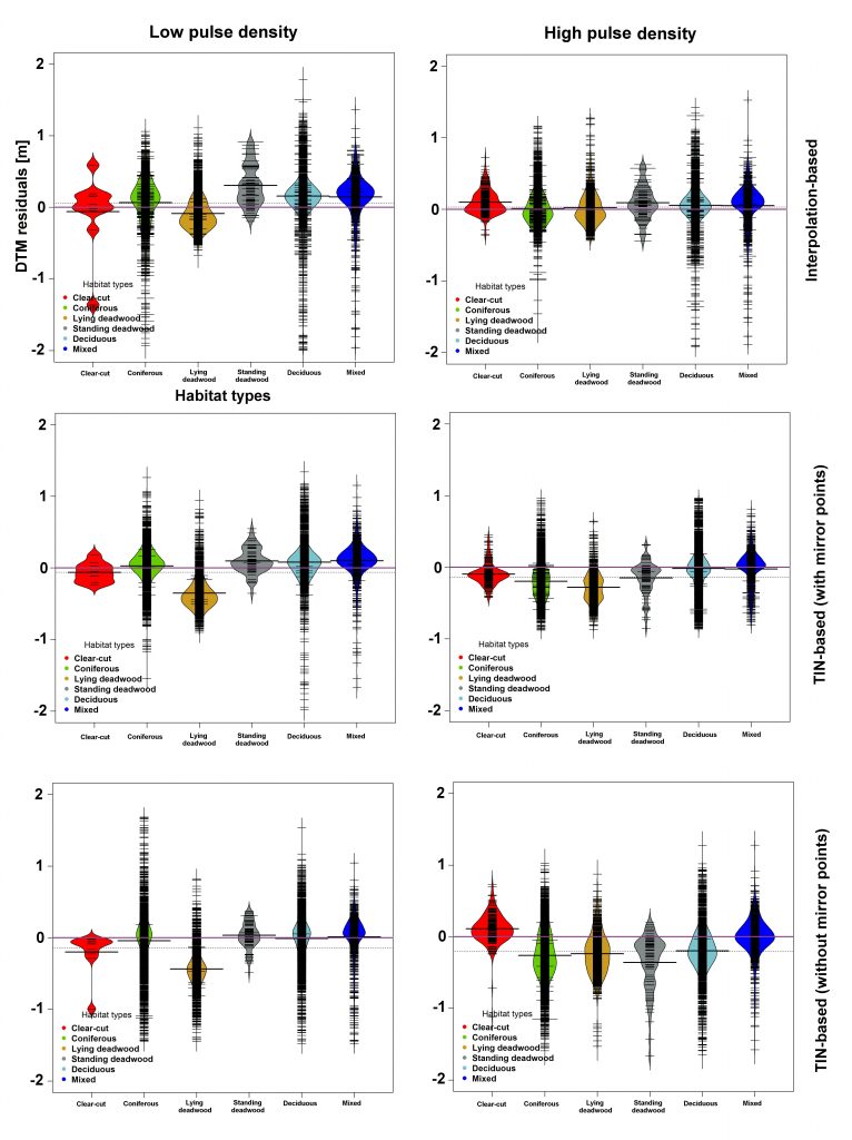
Impact of forest habitat types on residuals of DTMs extracted by interpolation- based (top row), adapted TIN based with mirror points (middle row), and adapted TIN based without mirror points (bottom row)

The results of a factorial analysis as ewll as a thorough validation of the quality of various DTM products within the Bavarian Forest National Park showed that topographic and forest habitat-type factors significantly contribute to the DTM accuracy, with pronounced efefcts observed mainly on south, southwest, and west slopes. Furthermore, an adaptive TIN ground-filtering algorithm with mirror points and followed by an interpolation-based algorithm contribute to comparatively lower errors on forest sites.

The full text can be retrieved here.

Aryal, R.R., Latifi, H., Heurich, M., Hahn, M. 2017. Impact of Slope, Aspect, and Habitat-Type on LiDAR-Derived Digital Terrain Models in a Near Natural, Heterogeneous Temperate Forest. PFG. DOI 10.1007/s41064-017-0023-2

 

you may also like:

Writing in Progress Across Europe!

Writing in Progress Across Europe!

This week, members of the COST Action DSS4ES from all over Europe — including colleagues from Türkiye — have gathered at the Earth Observation Research Cluster of the University of Würzburg for a dedicated writing retreat. Our goal? To collaboratively shape the...

New study on the conservation of biodiversity in West Africa

New study on the conservation of biodiversity in West Africa

A new study by our team, led by Insa Otte, on the conflict between biodiversity conservation in protected areas and agricultural development in West Africa has been published in the journal Natur und Landschaft. The abstract: According to the Human Development Report...

New review on slums and urban deprived areas

New review on slums and urban deprived areas

Researchers from TU Darmstadt, Karlstad University in Sweden, and our Earth Observation Research Cluster (EORC) at Julius-Maximilians-University Würzburg collaborated on a new study that looks at how science addresses urban deprived areas and slums worldwide. The...

Remote Sensing for Germany #1

Remote Sensing for Germany #1

Remote Sensing for Germany #1 In a recent #DLR press release (https://www.dlr.de/de/aktuelles/nachrichten/2025/dlr-zeigt-hohe-hitzebelastung-in-deutschen-grossstaedten), our remote sensing (RS) works on heat exposure in German cities have been shown.  The...