New publication: Further progress in model-based estimation of forest understorey by LiDAR data

New publication: Further progress in model-based estimation of forest understorey by LiDAR data

January 27, 2017

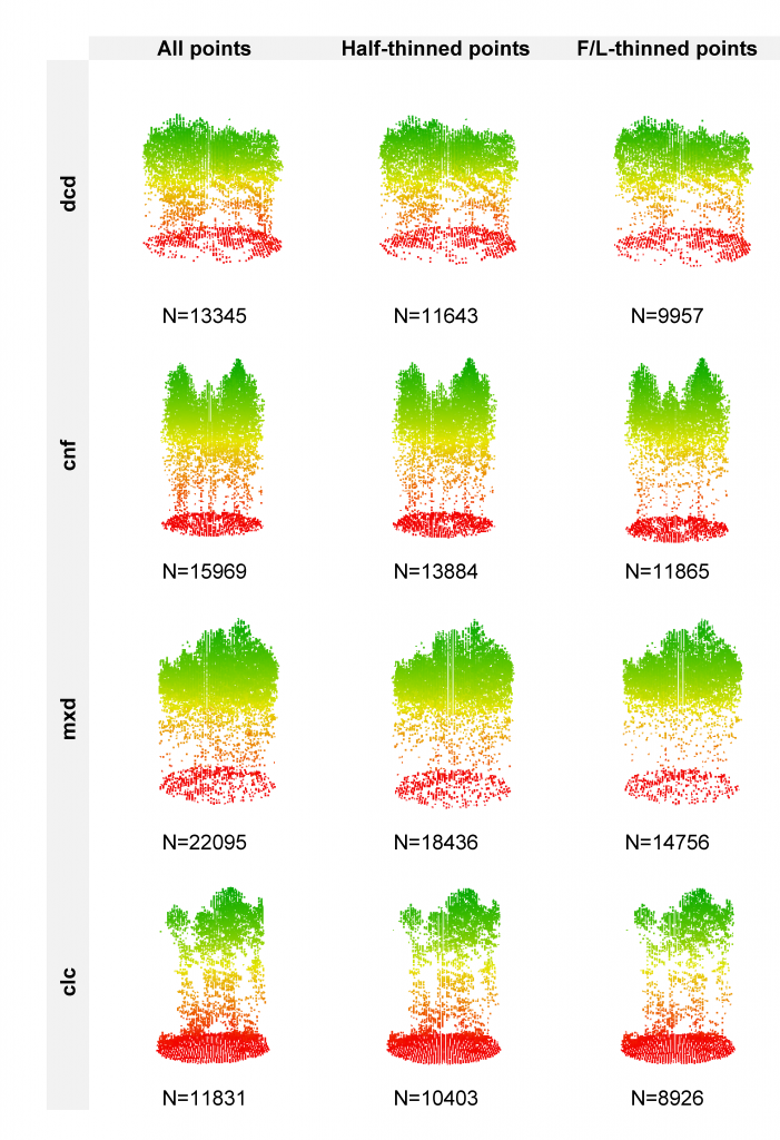
In a recently-published paper in Forestry featuring Hooman Latifi, Steven Hill and Stefan Dech from the Dept. of Remote Sensing, further advancements have been reported in developing unbiased statistical models for area-based estimation of forest understorey layers using LiDAR point cloud information. The study leveraged an original high-density LiDAR point cloud, which was further processed to simulate two lower-density datasets by applying a thining approach. The data were then combnined with three statistical modeling approaches to estimate the proportions of shrub, herb and moss layers in temperate forest stands in southeastern Germany.


Despite the differences between our simulated data and the real-world LiDAR point clouds
of different point densities, the results of this study are thought to mostly reflect how LiDAR and forest habitat data can be combined for deriving ecologically relevant information on temperate forest understorey vegetation layers. This, in turn, increases the applicability of prediction results for overarching aims such as forest and wildlife management.

Further informaiton on the published paper can be retrieved here.

Bibliography:

Latifi, H., Hill, S., Schumann, B., Heurich, M., Dech, S. 2017. Multi-model estimation of understorey shrub, herb and moss cover in temperate forest stands by laser scanner data. Forestry, DOI:10.1093/forestry/cpw066


you may also like:

New study on the conservation of biodiversity in West Africa

New study on the conservation of biodiversity in West Africa

A new study by our team, led by Insa Otte, on the conflict between biodiversity conservation in protected areas and agricultural development in West Africa has been published in the journal Natur und Landschaft. The abstract: According to the Human Development Report...

New review on slums and urban deprived areas

New review on slums and urban deprived areas

Researchers from TU Darmstadt, Karlstad University in Sweden, and our Earth Observation Research Cluster (EORC) at Julius-Maximilians-University Würzburg collaborated on a new study that looks at how science addresses urban deprived areas and slums worldwide. The...

Remote Sensing for Germany #1

Remote Sensing for Germany #1

Remote Sensing for Germany #1 In a recent #DLR press release (https://www.dlr.de/de/aktuelles/nachrichten/2025/dlr-zeigt-hohe-hitzebelastung-in-deutschen-grossstaedten), our remote sensing (RS) works on heat exposure in German cities have been shown.  The...

New study on invasive species in Rwanda

New study on invasive species in Rwanda

A new publication by EORC members Lilly Schell, Insa Otte, Sarah Schönbrodt-Stitt and Konstantin Müller, was just published   in the Journal Frontiers in Plant Science. Their study, “Synergistic use of satellite, legacy, and in situ data to predict spatio-temporal...