new article: Satellite remote sensing for applied ecologists: opportunities and challenges

new article: Satellite remote sensing for applied ecologists: opportunities and challenges

August 4, 2014

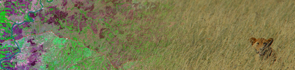
our new review article about opportunities and challenges for ecologists using remote sensing lead by Nathalie Pettorelli has been published. We focused on remote sensing topics related to challenges of applied ecologists, highlighting the potential as well as caveats and of course the future developments.

resized_earth-observation_org_WegmannBevanda_gradient_lionseronera_RS

  1. Habitat loss and degradation, overexploitation, climate change and the spread of invasive species are drastically depleting the Earth’s biological diversity, leading to detrimental impacts on ecosystem services and human well-being.
  2. Our ability to monitor the state of biodiversity and the impacts of global environmental change on this natural capital is fundamental to designing effective adaptation and mitigation strategies for preventing further loss of biological diversity. This requires the scientific community to assess spatio-temporal changes in the distribution of abiotic conditions (e.g. temperature, rainfall) and in the distribution, structure, composition and functioning of ecosystems.
  3. The potential for satellite remote sensing (SRS) to provide key data has been highlighted by many researchers, with SRS offering repeatable, standardized and verifiable information on long-term trends in biodiversity indicators. SRS permits one to address questions on scales inaccessible to ground-based methods alone, facilitating the development of an integrated approach to natural resource management, where biodiversity, pressures to biodiversity and consequences of management decisions can all be monitored.
  4. Synthesis and applications. Here, we provide an interdisciplinary perspective on the prospects of satellite remote sensing (SRS) for ecological applications, reviewing established avenues and highlighting new research and technological developments that have a high potential to make a difference in environmental management. We also discuss current barriers to the ecological application of SRS-based approaches and identify possible ways to overcome some of these limitations.
Pettorelli, N., Laurance, W. F., O’Brien, T. G., Wegmann, M., Nagendra, H., & Turner, W. (2014). Satellite remote sensing for applied ecologists: opportunities and challenges. Journal of Applied Ecology.

http://onlinelibrary.wiley.com/doi/10.1111/1365-2664.12261/abstract

follow us and share it on:

you may also like:

Drone manufacturer Wingtra visits EORC

Drone manufacturer Wingtra visits EORC

Is it possible to combine the efficiency of a fixed-wing drone with the precision of a laser scanner? That question brought researchers from EORC together with Wingtra, a Swiss company designing and manufacturing fixed-wing UAS, to exchange on UAS research and discuss...

How We Learned to Fly: The Story Behind UAS Research at EORC

How We Learned to Fly: The Story Behind UAS Research at EORC

Every research group that's ever bought a drone has a story about the first one it lost. We're no different. So let's just get that out of the way up front: this is the inside story of how UAS (Unoccupied Aerial System) research grew up at the Earth Observation...

MainPro workshop on TLS and LiDAR UAS

MainPro workshop on TLS and LiDAR UAS

This week, a workshop organized by Sebastian Buchelt within our EFRE project MainPro brought together students, researchers, and interested project partners to explore modern UAV technologies. The workshop took place in vineyards close to Würzburg and gave the...

25 Years of Remote Sensing in Würzburg

25 Years of Remote Sensing in Würzburg

Our chair of remote sensing, Professor Stefan Dech, likes to say "science is rarely a sprint, it's a marathon". And if you look at what's grown out of Würzburg over the last 25 years, you'll see exactly what he means. In 2026 the Julius-Maximilians-Universität...

Starkregen in Bayern: Beobachtungen und Dokumentation zählen

Starkregen in Bayern: Beobachtungen und Dokumentation zählen

Starkregenereignisse treten immer häufiger lokal, kurzfristig und mit hoher Intensität auf. Innerhalb weniger Stunden können sie erhebliche Überschwemmungen und Schäden verursachen. Um solche Ereignisse künftig besser zu verstehen und die wissenschaftliche Grundlage...

Seeing the World in Points: Lidar Course for the EAGLEs

Seeing the World in Points: Lidar Course for the EAGLEs

Lidar has a funny way of sneaking up on you. You think you know what it is, a laser that measures distance, fine, but then someone shows you a point cloud of a forest canopy with individual branches floating in 3D space and suddenly you realize there's a whole...

Share This