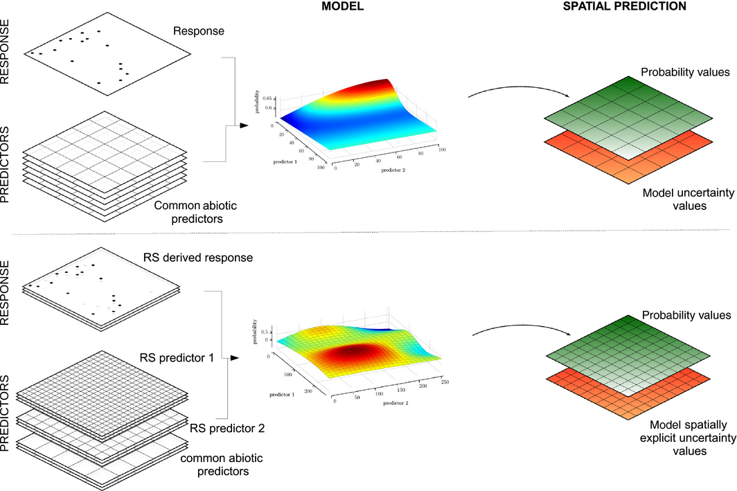
 our new article “Will remote sensing shape the next generation of species distribution models?” in Remote Sensing in Ecology and Conservation is now online. Two prominent limitations of species distribution models (SDMs) are spatial biases in existing occurrence data and a lack of spatially explicit predictor variables to fully capture habitat characteristics of species. Can existing and emerging remote sensing technologies meet these challenges and improve future SDMs? We believe so. Novel products derived from multispectral and hyperspectral sensors, as well as future Light Detection and Ranging (LiDAR) and RADAR missions, may play a key role in improving model performance. In this perspective piece, we demonstrate how modern sensors onboard satellites, planes and unmanned aerial vehicles are revolutionizing the way we can detect and monitor both plant and animal species in terrestrial and aquatic ecosystems as well as allowing the emergence of novel predictor variables appropriate for species distribution modeling. We hope this interdisciplinary perspective will motivate ecologists, remote sensing experts and modelers to work together for developing a more refined SDM framework in the near future.

EORC and EAGLE summer BBQ
We’re happy to announce that our summer BBQ is happening again on Thursday, July 24th at 4pm! Alongside good food and a relaxed atmosphere, we’re also hosting a series of short talks highlighting exciting topics in Earth Observation and environmental science: “The...