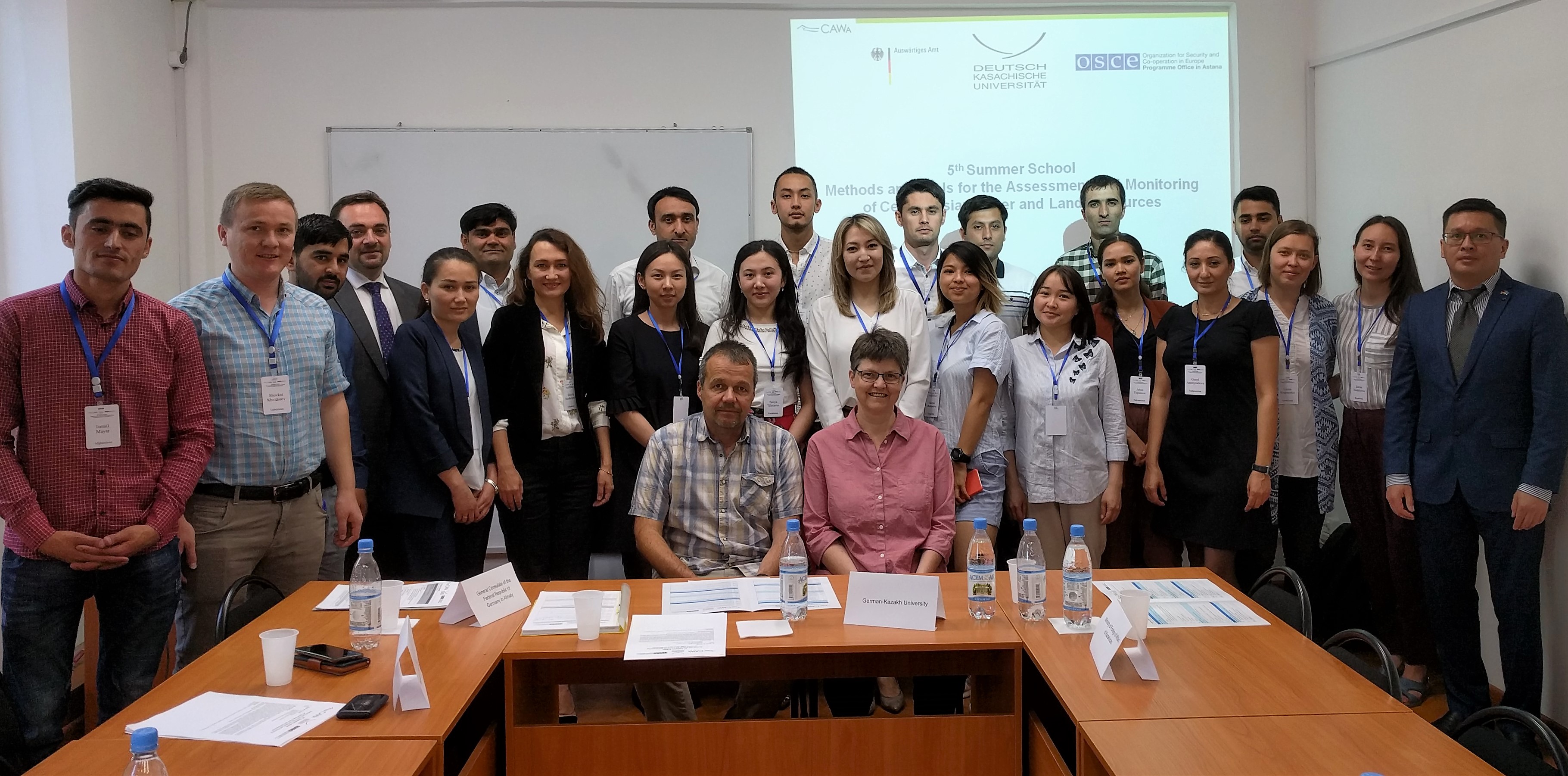
 23 master and PhD students as well as junior university teachers and young specialists from government agencies and research institutions participated into the two-week 5th CAWa Summer School “Methods and Tools for the Assessment and Monitoring of Central Asian Water and Land Resources” (June 11-22, 2018) that was hosted by the German-Kazakh University in Almaty, Kazakhstan (DKU). Lucia Morper-Busch and Maik Netzband from the Department of Remote Sensing, Würzburg University, teached in the first week and addressed GIS (QGIS) and Remote Sensing.
Participants came from Kazakhstan, Kyrgyzstan, Tajikistan, Turkmenistan, Uzbekistan as well as from Afghanistan.
Participants and trainers (Lucia Morper-Busch and Maik Netzband, sitting) of the fifth CAWa Summer School (first week) held in the German-Kazakh University in Almaty, Kazakhstan
This year’s CAWa Summer School was already the fifth in a row. It was organized by
- the CAWa Project (funded by the German Federal Foreign Office),
- the German-Kazakh University in Almaty (Kazakhstan),
- the Würzburg University, Institute for Geography and Geology, Department of Remote Sensing (Germany) and
- the Helmholtz Centre Potsdam, GFZ German Research Centre for Geosciences, Hydrology Section (Germany),
in cooperation with
- the Institute of Geography, Almaty (Kazakhstan) and
- the Kazakstan Gharysh Sapary (National space agency), Astana.
The CAWa Summer School was supported by the OSCE Programme Office Astana (Kazakhstan).
Focus was set on innovative methods and tools for the analysis and monitoring of water and land resources in Central Asia that are of great value in integrated water and land resource management. Therefore, theoretical lectures and practical exercises were combined with discussion sessions on the implementation of new methods and instruments for managing the water and land resources. The program included an in-depth introduction to GIS, an overview of remote sensing applications for water and land resource monitoring, an introduction to climatological data analysis, and an introduction to glaciology.
Particular emphasis was placed on the CAWa online tool WUEMoCA (Water Use Efficiency Monitor in Central Asia).