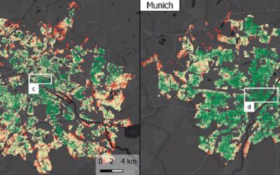
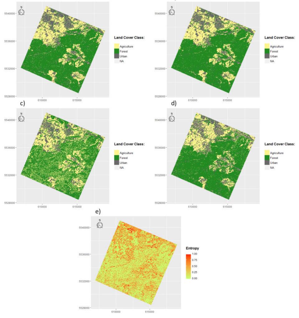
 Marius Philipp handed in his B.Sc. thesis on “Spectral and spatial resolution of remote sensing data and its impact on classification processes – A case study of the Bavarian Steigerwald”. From the abstract: Remote sensing data enables a highly potent and cost efficient way for extracting thematic information such as land cover types and their distribution. A common area of application is therefore the creation of land cover and land use maps. But since this is a complex decision-making process, a successful execution of this task can prove to be rather difficult. Choosing suitable imagery in terms of its spatial and spectral resolution can highly affect the accuracy results of the finished product and should therefore be carefully considered beforehand. In order to assist ecologists by giving them a reference point for choosing the best suited data, this study contains comparisons of several remotely sensed data sets with different spatial and spectral features. Four individual classification algorithms are applied in a multi-level classification approach on numerous scales, which is designed to be increasingly complex with each classification scheme. Results of this study reveal, that higher spatial and spectral resolutions do not always generate more accurate classification results. It is shown, that satellite imagery with a medium spatial resolution tend to create better land cover maps compared to high resolution images. Furthermore, the individual classification algorithms tend to strongly affect the quality of the classification products as well, which creates another import decision point that will be discussed in this study.
supervisor: Dr. Martin Wegmann in collaboration with the Steigerwald research station.