Our article in MEE got accepted “r.pi: a GRASS GIS package for semi-automatic spatial pattern analysis of remotely sensed land cover data” by Martin Wegmann, Benjamin Leutner, Markus Metz, Markus Neteler, Stefan Dech, Stefan and Duccio Rocchini. It outlines the capabilities of the r.pi package to analyze spatial patterns derived from remote sensing land cover data to inform about landscape conditions and changes. Such fragmentation measures are relevant for ecology or conservation as well as for remote sensing to produce value-added landcover maps that provide details on the spatial structure of the landscape.

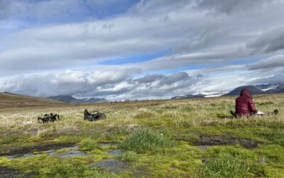
Linking Science and Practice: Exploring Earth Observation for Water Management
How can Earth observation support sustainable water management in times of climate change? This question was at the center of a recent visit by participants of the EAGLE block course "Linking Science and Practice in Earth Observation for Climate Adaptation" to the...